
Ninh Binh develops modern, synchronised infrastructure toward centrally governed city
Opening up new development corridors
Ninh Binh is one of seven provinces through which the Hanoi Capital Region Ring Road No. 5 project passes. The section running through the province is approximately 35.3 km long and traverses 10 communes and wards. It is planned as a six-lane expressway, accompanied by parallel roads and collector roads connecting with the local transport network.
The route is expected to strengthen connectivity and expand socio-economic development space, particularly in planned urban, industrial, service and logistics areas along the corridor.
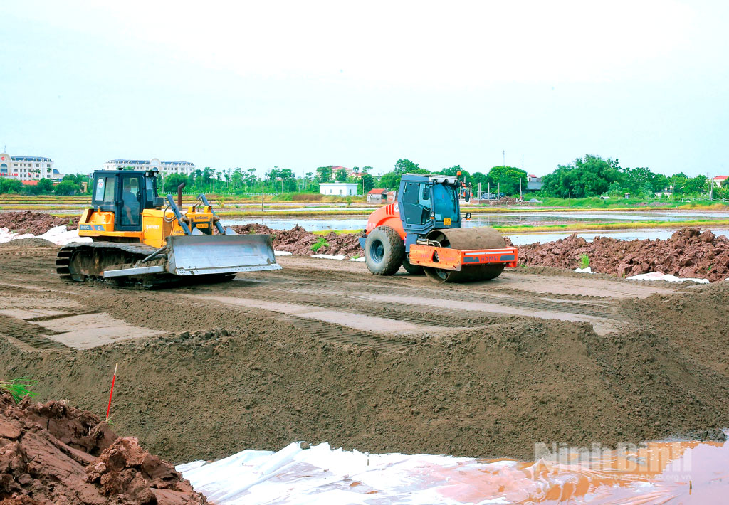
The province has been implementing parallel-road projects along several sections, including the routes from D5 Road to the Nhue River dike; from the Nhue River dike to the 68-metre road; from Phu Thu Interchange to Binh Nghia Interchange; and from Binh Nghia Interchange to Thai Ha Interchange. The sections have a combined length of approximately 29 km and cover about 415.7 hectares.
To date, local authorities have completed site clearance and handed over around 257 hectares, or nearly 61%, while approximately 158.7 hectares remain to be handed over.
On the cleared sites, contractors have completed earth excavation and embankment works and carried out treatment of weak soil foundations.
Nguyen Quang Huy, Director of the provincial Construction Investment Project Management Board No. 3, said the board is coordinating with local authorities to review remaining obstacles while asking contractors to mobilise manpower and equipment to construction sites where land has already been handed over.
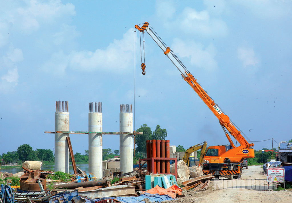
Following the approach of starting construction wherever sites are available, a number of works, including Den Bridge, Kenh Thuy Loi Bridge, Tien Tan Bridge and Long Xuyen Bridge, have been basically completed or are under construction, with work progressing on beams, abutments and piers.
The section from the Nhue River dike to the 68-metre road has basically completed roadbed construction, drainage systems, landscaping, lighting and traffic safety facilities.
While construction of the Ring Road No. 5 parallel roads is being accelerated, the province is preparing to invest in a new transport route connecting Hoa Lu with Nam Dinh.
On August 24, 2026, the Chairman of the provincial People's Committee issued a decision approving the project to build a key economic and socio-economic development road linking Hoa Lu and Nam Dinh.
The Group A project is classified as a Grade I transport facility, while the bridge crossing the Day River is classified as a special-grade structure.
The project will have a total length of 39 km and an estimated investment of 7.14 trillion VND, excluding separate components for compensation, support, resettlement and site clearance. Construction is scheduled to run from 2026 to 2029.
The route is designed to enhance connectivity between Hoa Lu and Nam Dinh, facilitating travel and trade while supporting tourism, commerce and services.
Passing through areas rich in historical and cultural relics, the route will also link tourism spaces across the province following its administrative merger.
The Hoa Lu-Nam Dinh road project is part of a broader plan to reorganize the urban space in the central area.
The province has approved the planning task for a detailed urban plan covering both banks of the Day River, with a study area of approximately 6,670 hectares and a projected population of around 650,000. The area includes Hoa Lu, Tay Hoa Lu and Dong Hoa Lu wards, as well as Gia Tran, Phong Doanh, Y Yen and Yen Dong communes.
The planned area is designated as a key urban development zone and the province's administrative, political, economic, cultural and service center. It is also envisioned as a major transport hub and a southern gateway to the Red River Delta.
Under the plan, the Day River will become a central landscape and public-space axis. The eastern bank will be developed into a modern, integrated and smart urban area, while the western bank will focus on preserving village structures, water systems and historical and cultural values.
Alongside transport projects and key urban development plans, Ninh Binh is implementing 52 key tasks, schemes and projects.
These include five national-level key projects identified by the central government for implementation in the province, along with 47 provincial-level key tasks and projects. Of the latter, 22 are financed by public investment capital and 25 by non-budgetary sources.
The provincial People's Committee has also issued a decision approving a list of 27 projects seeking investment in the first phase of 2026. The projects cover more than 1,834 hectares, with total expected investment of nearly 7 trillion VND across six sectors.
These projects are expected to provide additional resources for gradually completing technical infrastructure and meeting the criteria for a centrally governed city.
Completing criteria for a centrally governed city
The project to transform Ninh Binh into a centrally governed city before 2030 aims to help the province meet Grade I urban criteria while developing social and technical infrastructure in a comprehensive manner in line with regulations on urban classification and administrative units.
Following the merger, Ninh Binh has four Grade II urban centres, namely Hoa Lu, Nam Dinh, Phu Ly and Tam Diep as well as 34 Grade III urban centres under transitional regulations. Each urban centre has its own functions and strengths and plays an important role in the province's socio-economic development.
However, the province's urbanisation rate stood at only around 36% in 2025. The number of arterial and backbone roads remains insufficient to meet connectivity needs among urban areas, industrial parks, tourism zones and coastal areas.
Implementing Resolution No. 11-NQ/TU dated January 30, 2026 of the Provincial Party Committee's Standing Board on developing an synchronised and modern infrastructure system, Ninh Binh has adopted a spatial development model featuring “one key development axis two development ends three development poles four economic zones five economic corridors.”
Under the model, priority will be given to transport infrastructure connecting urban areas, industrial parks and tourism destinations with the national transport network, thereby creating better conditions for socio-economic development.
Beyond the central urban area, the province plans to develop urban centres associated with high-speed railway stations, airports, seaports, economic zones, industrial parks and tourism areas.
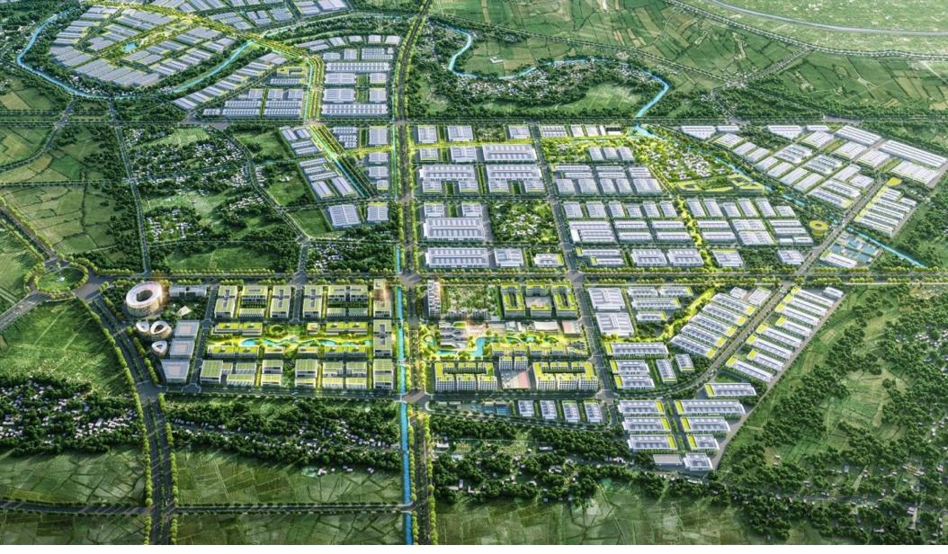
New development areas are required to have synchronized infrastructure, including transport networks, power and water supply, drainage and waste treatment systems, as well as essential social infrastructure.
In 2026, the province aims to raise its urbanisation rate to at least 40% and add at least four wards reaching the development standards of Grade II urban areas.
By 2027, the urbanisation rate is targeted at 45% or higher, with at least half of all wards reaching Grade II urban development standards.
The province aims to complete at least three regional-level transport hubs, major gateways and regional connectivity centers, while finalizing the dossier for recognition of Ninh Binh as meeting Grade I urban criteria for submission to competent authorities for consideration and approval.
By 2030, Ninh Binh aims to raise its urbanisation rate to more than 60%.
Alongside urbanisation targets, the province must ensure that its urban areas have the capacity to withstand and adapt to climate change, develop public transport, complete technical and social infrastructure, and improve the quality of services for residents.
Therefore, transport investment must be closely aligned with urban planning, land-use plans and environmental protection requirements.
From now until 2030, Ninh Binh faces a substantial workload, while many projects continue to encounter difficulties related to site clearance, resettlement, construction materials and the relocation of technical infrastructure.
Resolving these bottlenecks, accelerating key projects and effectively implementing approved plans will provide a solid foundation for Ninh Binh to gradually fulfill the required criteria and realize its goal of becoming a centrally governed city./.
Tin liên quan



Tin cùng chuyên mục